

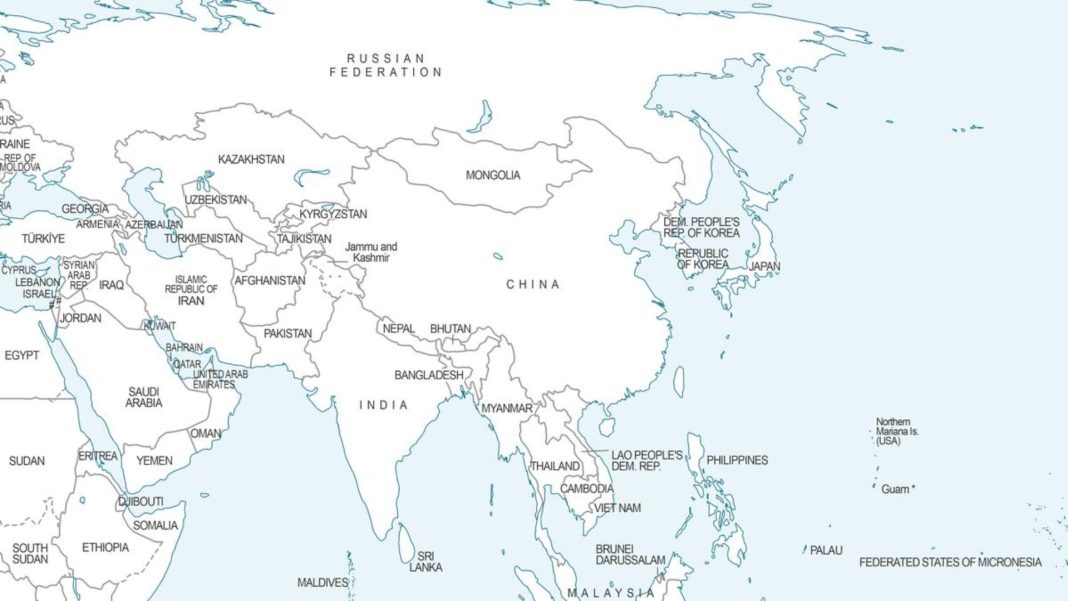

UN Map Controversy: A fresh geopolitical controversy has erupted after a newly surfaced world map issued by the United Nations (UN) depicted key Indian border regions under contested, non-standard designations. The map, which alters long-standing cartographic depictions of Arunachal Pradesh, Aksai Chin, and Jammu & Kashmir, has triggered sharp reactions among diplomatic observers and policy experts in New Delhi.
The UN map illustrates overlapping territorial claims in Asia, but its specific handling of India’s northeastern and northern borders has raised serious concerns regarding international cartographic neutrality and territorial integrity.
What’s in the Map? The Key Visual Changes
UN Map Controversy: The updated UN depiction introduces several controversial markings along India’s northern and northeastern frontiers:
Arunachal Pradesh Relabeled: The map outlines Arunachal Pradesh and Aksai Chin with separate lines representing the conflicting claims of both India and China.
The ‘Chinese Line’ on Assam’s Border: The southern border separating Arunachal Pradesh from Assam is marked as a ‘Chinese Line’, implying a shift in administrative and territorial recognition.
Erased Boundaries: The internal administrative border between Arunachal Pradesh and Nagaland has been completely removed from the map.
The ‘Indian Line’ in Tibet: Conversely, the northern boundary separating Arunachal Pradesh from China’s Autonomous Region of Tibet is designated as an ‘Indian Line’.
Dotted Line across Jammu & Kashmir: Along the Line of Control (LoC) separating Indian and Pakistani-administered Jammu & Kashmir, the map uses a prominent dotted line accompanied by a clarifying disclaimer.
Map Disclaimer Note: The UN inserted an explicit footnote alongside the dotted line across Jammu & Kashmir, stating: “This line represents an approximate representation of the Line of Control (LoC). The final status of Jammu and Kashmir has not yet been agreed upon by the parties.”
Why Is India Concerned?
UN Map Controversy: For decades, India has maintained a firm, zero-tolerance policy regarding its official boundary depictions. According to Indian cartographic guidelines and constitutional law, the entire state of Arunachal Pradesh, along with the entire territory of Jammu, Kashmir, and Ladakh (including Aksai Chin and Pakistan-occupied Kashmir), are integral, non-negotiable parts of the Republic of India.
- Legitimizing Unilateral Claims
Diplomatic analysts point out that by drawing a ‘Chinese Line’ along Assam’s border, the UN map inadvertently gives visual legitimacy to Beijing’s expansive claims over Arunachal Pradesh (which China refers to as ‘Zangnan’ or South Tibet).
- Undermining Internal Federal Boundaries
Erasing the boundary line between Assam, Nagaland, and Arunachal Pradesh distorts the internal administrative governance of a sovereign state. In international cartography, internal state borders are typically preserved regardless of external territorial disputes.
- Neutralizing the Status of the Line of Control
While the UN has historically used dotted lines for disputed borders, marking the LoC in Jammu & Kashmir with vague disclaimers continues to draw criticism from New Delhi, which views Kashmir as a bilateral issue under the 1972 Simla Agreement.
Geopolitical Context: The Larger Sino-Indian Border Puzzle
This cartographic row comes against a backdrop of prolonged diplomatic and military standoff along the Line of Actual Control (LAC) between India and China.
China has routinely published “standard maps” claiming Indian territories, including Arunachal Pradesh and Aksai Chin. Whenever international organizations, such as the UN, foreign publishers, or tech platforms, adopt hybrid boundary lines to accommodate these claims, it sparks significant friction with Indian authorities.
Diplomatic Options and Next Steps
Historically, whenever international agencies or global media outlets publish inaccurate maps of India, the Ministry of External Affairs (MEA) issues formal protests and requests immediate rectifications.
Expected responses from India include:
Formal Diplomatic Protest: Filing a diplomatic note with the United Nations Secretariat requesting the correction of internal state borders and the removal of labels like the ‘Chinese Line’ within Indian territory.
Reiteration of Sovereign Stand: Issuing a statement reaffirming that Arunachal Pradesh and Aksai Chin remain integral parts of India, irrespective of external cartographic representations.
Cartographic Compliance Enforcements: Ensuring that global organizations operating within India adhere to the Criminal Law Amendment Act, which regulates the public depiction of India’s international boundaries.
The Broader Impact on International Cartography
International bodies like the UN often attempt to remain neutral by showing multi-claimant boundary lines. However, cartographers note that when standardizing contested borders, even subtle shifts in line styles, labels, or omitted internal boundaries can carry heavy geopolitical weight.
As this issue unfolds, all eyes remain on how the United Nations Secretariat responds to the growing concerns raised over its cartographic representations in South Asia.